Our Department have to make an hard decision and keep our office Closed
Due to a lot of Dangerous/Flooding our office will remain closed on August 31/September 1
Location: Louisiana
All Office In Louisiana Will Be Closed On August 31,2021 & September 1,2021 Due To Hurricane 🌀 IDA
Location Added: Alabama
All Office In Alabama Will Be Closed On August 31,2021 & September 1,2021 Due To Hurricane 🌀 IDA
Location Just Added: Georgia
Our Department just announced around August 30,2021 5:30PM EDT that our office will be closed due to the weather threat
Our Weather Service/Department will announced for details for September 1,2021 if necessary
All Office In Georgia Will Be Closed On August 31,2021 Due To The Weather Threat
Flash Flood Watch from TUE 8:00 AM EDT until WED 2:00 PM EDT
Action Recommended
Avoid the subject event as per the instructions
Issued By
Atlanta - GA, US, National Weather Service
Affected Area
Pickens County
Description
...FLASH FLOOD WATCH REMAINS IN EFFECT FROM TUESDAY MORNING THROUGH WEDNESDAY AFTERNOON... The Flash Flood Watch continues for Portions of north central Georgia, northeast Georgia and northwest Georgia, including the following areas, in north central Georgia, Cherokee, Dawson, Fannin, Gilmer, Lumpkin, Pickens and Union. In northeast Georgia, Towns and White. In northwest Georgia, Bartow, Catoosa, Chattooga, Dade, Floyd, Gordon, Murray, Walker and Whitfield. From Tuesday morning through Wednesday afternoon. Rainfall associated with Tropical Storm Ida will begin to move into portions of western Georgia this afternoon and expand across the rest of the area through Tuesday evening. 3 to 5 inches of rain is expected through the flash flood watch area with isolated higher amounts possible. As the remnants of Ida moves through, additional bands of rainfall may cause training of storms through Wednesday that may lead to additional flash flooding concerns. PRECAUTIONARY/PREPAREDNESS ACTIONS... You should monitor later forecasts and be prepared to take action should Flash Flood Warnings be issued.
Flash Flood Watch
Georgia
0 secs ago – National Weather Service
FLASH FLOOD WATCH REMAINS IN EFFECT FROM TUESDAY MORNING THROUGH WEDNESDAY AFTERNOON... The Flash Flood Watch continues for * Portions of north central Georgia, northeast ...
Flash Flood Watch
Alert summary
...FLASH FLOOD WATCH REMAINS IN EFFECT FROM TUESDAY MORNING THROUGH
WEDNESDAY AFTERNOON...
The Flash Flood Watch continues for
* Portions of north central Georgia, northeast Georgia and northwest
Georgia, including the following areas, in north central Georgia,
Cherokee, Dawson, Fannin, Gilmer, Lumpkin, Pickens and Union. In
northeast Georgia, Towns and White. In northwest Georgia, Bartow,
Catoosa, Chattooga, Dade, Floyd, Gordon, Murray, Walker and
Whitfield.
* From Tuesday morning through Wednesday afternoon.
* Rainfall associated with Tropical Storm Ida will begin to move
into portions of western Georgia this afternoon and expand across
the rest of the area through Tuesday evening. 3 to 5 inches of
rain is expected through the flash flood watch area with isolated
higher amounts possible. As the remnants of Ida moves through,
additional bands of rainfall may cause training of storms through
Wednesday that may lead to additional flash flooding concerns.
Expires in 2 days.
News
News about Flash Flood Watch
Safety tips
Elevate the furnace, water heater and electric panel in your home if you live in an area that has a high flood risk.
Consider installing "check valves" to prevent flood water from backing up into the drains of your home.
If feasible, construct barriers to stop floodwater from entering the building and seal walls in basements with waterproofing compounds.
Be aware that flash flooding can occur.
If there is any possibility of a flash flood, move immediately to higher ground. Do not wait for instructions to move.
Turn off utilities at the main switches or valves if instructed to do so. Disconnect electrical appliances. Do not touch electrical equipment if you are wet or standing in water.
Secure your home. If you have time, bring in outdoor furniture. Move essential items to an upper floor.
Be aware of stream, drainage channels, canyons and other areas known to flood suddenly.
Flash floods can occur in these areas with or without typical warnings such as rain clouds or heavy rain.
Do not walk through moving water. Use a stick to check the firmness of the ground in front of you.
Six inches of moving water can make you fall. If you have to walk in water, walk where the water is not moving.
Do not drive into flooded areas. If floodwaters rise around your car, abandon the car and move to higher ground if you can do so safely.
You and the vehicle can be swept away quickly.
Do not camp or park your vehicle along streams, rivers or creeks, particularly during threatening conditions.
Be aware to the following details:
• Hurricane 🌀 IDA
• Flooding
• Wind 💨 🌬 🌬
• Rain ☔️ 🌧
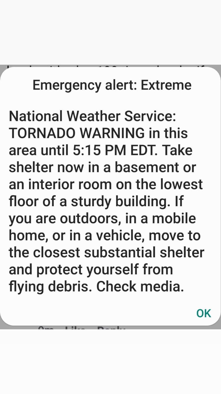
• Tornado 🌪 Warning/Watch
• Falling Tree
• Power Link
• Phone Line
• Flying Items
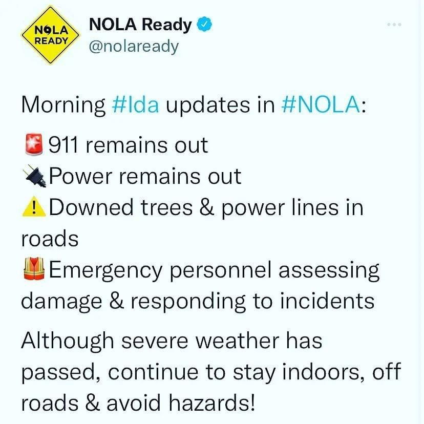
🚨The Tangi 9-1-1 lines are down.
🚨The temporary number to call is 985-748-3246.
🌀 LAST UPDATE 🌀


